Introduction: A Profession at an Inflection Point
Civil engineering has always absorbed technology. The transit level replaced the plumb bob. CAD replaced the drawing board. GIS replaced hand-drawn topographic maps. Numerical modelling replaced slide-rule hydraulics. Each wave of technology changed what engineers spent their time doing, but did not eliminate the need for engineers. We are now in the early stages of another such wave — one that is arguably more disruptive in character, because it does not merely automate mechanical tasks but begins to automate cognitive ones.
Artificial intelligence — and in particular machine learning, deep learning, and large language models — is being applied across the full spectrum of civil and water resources engineering: design optimisation, structural health monitoring, flood early warning, geotechnical risk assessment, construction progress tracking, cost estimation, environmental impact screening, and document review. In some of these applications, AI systems already outperform experienced human practitioners on narrow, well-defined tasks. In others, the technology remains immature, poorly validated, or unsuitable for the institutional and data environments found in developing countries.
This article attempts an honest, technically grounded survey of the landscape — what AI can genuinely do today, what it cannot, what the trajectory looks like over the next decade, and what it means for engineers practising in Nigeria and the broader African context. We conclude with the question that everyone in the profession is quietly asking: can AI take civil engineering jobs?
1. Structural Engineering: Design Optimisation and Health Monitoring
Generative design and topology optimisation
Structural optimisation is one of the most mathematically tractable applications of AI in civil engineering, and one where machine learning has found genuine traction. Traditional structural design involves an engineer selecting a structural system, sizing members, checking against code, and iterating. This process is experienced-guided but inherently exploratory — the engineer cannot check more than a handful of configurations in the time available.
Generative design algorithms, driven by machine learning and evolutionary computation, can explore thousands of design configurations simultaneously, optimising for competing objectives — minimum material, minimum deflection, minimum cost, minimum carbon — subject to code and constructability constraints. Tools like Autodesk Fusion's generative design module, Rhino-Grasshopper with Karamba3D, and research implementations using genetic algorithms and neural network surrogate models are being used in bridge design, long-span roof structures, and foundation optimisation.
For routine work — reinforced concrete frames, retaining walls, standard foundation types — AI-assisted parametric design tools are now commercially available that can size and check members automatically against multiple design codes, including Eurocode and ACI. The engineer's role shifts from calculation to validation, interpretation, and engineering judgement on scheme selection.
Structural health monitoring (SHM)
Perhaps the most mature AI application in structural engineering is the automated interpretation of sensor data for structural health monitoring. Bridges, dams, high-rise buildings, and long-span structures are increasingly instrumented with networks of accelerometers, strain gauges, displacement sensors, and fibre-optic distributed sensing systems. The volume of data these systems generate far exceeds what human analysts can review manually.
Machine learning models — particularly anomaly detection algorithms and Long Short-Term Memory (LSTM) neural networks — are applied to continuously identify deviations from baseline structural behaviour that may indicate damage, deterioration, or impending failure. Systems trained on the structural response of bridges under known loading conditions can detect changes in modal frequencies, damping ratios, and mode shapes that correlate with specific damage types, enabling condition-based maintenance decisions that reduce both risk and cost.
Computer vision has extended SHM to visual inspection. Deep learning models trained on large crack and defect datasets can identify, classify, and measure surface distress in concrete and steel structures from photographs or video with accuracy comparable to — and in terms of speed and consistency, exceeding — that of trained human inspectors. Commercial platforms such as Doxel, Reconstruct, and Ai Build deploy this capability in construction and asset management contexts.
A 2023 study published in Engineering Structures found that a convolutional neural network trained on 40,000 crack images detected concrete surface cracks with 96.5% accuracy — comparable to expert human inspectors — but at a fraction of the time and cost, and with perfect consistency across repetitions.

2. Geotechnical Engineering: Uncertainty, Prediction, and Site Characterisation
Machine learning for subsurface characterisation
Geotechnical engineering is fundamentally concerned with managing uncertainty. The ground is spatially variable, often in ways that cannot be fully characterised by any affordable investigation programme. Machine learning offers new tools for interpolating and extrapolating subsurface properties between investigation points — a task that has traditionally been done by kriging and other geostatistical methods, but which neural networks and Gaussian Process Regression can now approach with greater flexibility and sometimes greater accuracy.
Supervised machine learning models trained on CPT (Cone Penetration Test) and SPT (Standard Penetration Test) databases can predict soil classification, undrained shear strength, compression index, and liquefaction susceptibility with known uncertainty bounds. These predictions are particularly useful in data-rich urban environments where large databases of historical investigation data exist and can be used to infer subsurface conditions at new sites before drilling.
Slope stability and failure prediction
Rainfall-triggered slope failures are a major hazard in West Africa, particularly in areas of deeply weathered lateritic soils and steep topography. Traditional slope stability analysis is site-specific and computationally expensive, limiting its application to individual slopes of known concern. Machine learning-based regional susceptibility mapping — using Random Forest, Support Vector Machine, or gradient boosting classifiers trained on historical failure inventories and topographic, geological, hydrological, and land use covariates — enables probabilistic assessment of slope failure risk across entire catchments or administrative areas.
These models do not replace detailed site investigation for specific infrastructure projects, but they provide a rational, spatially explicit basis for identifying high-risk corridors during road alignment selection and dam site screening — tasks that currently rely heavily on informal field reconnaissance.
In the Nigerian context, AI-based landslide susceptibility mapping using SRTM topography, CHIRPS rainfall, and geological datasets could significantly improve the siting of rural roads in the Middle Belt and South-East geomorphic zones, where rainfall-triggered failures cause substantial economic losses and disruption annually.
3. Hydrology and Flood Forecasting: The Strongest Case for AI in Water Resources
If there is one domain of water resources engineering where AI has delivered the most convincing and best-documented improvements in performance, it is flood forecasting. The reasons are structural: hydrological forecasting is a pattern recognition problem involving large datasets of rainfall and flow observations, and pattern recognition is precisely what modern machine learning does best.
Data-driven rainfall-runoff models
Traditional rainfall-runoff modelling — HEC-HMS, SWAT, HBV, and their family — relies on physically derived equations that simulate interception, infiltration, overland flow, channel routing, and baseflow. These models require careful calibration against observed streamflow data and struggle in ungauged basins where no calibration data exists.
Long Short-Term Memory (LSTM) neural networks have demonstrated a remarkable ability to learn the rainfall-runoff relationship from historical data without requiring any explicit representation of hydrological processes. A landmark 2019 study by Kratzert et al. showed that a single LSTM model trained across 531 CAMELS basins in the USA outperformed individually calibrated conceptual models in the majority of basins — including, crucially, in basins with poor streamflow data. Google's MeteoNet and DeepMind's GraphCast weather prediction system represent the frontier of AI-driven meteorological and hydrological prediction at global scale.
For operational flood early warning, AI models offer a critical advantage: once trained, they produce forecasts in milliseconds. A traditional ensemble hydrological forecast may take hours to run on a high-performance computing cluster. An LSTM can deliver probabilistic 72-hour flow forecasts for hundreds of gauged basins simultaneously, enabling real-time flood monitoring at national scale — exactly the capability that Nigeria's hydrological forecasting system needs.
Ungauged basin estimation
Over 80% of river basins in sub-Saharan Africa are effectively ungauged — they have no streamflow measurement record, or records that are too short and discontinuous for reliable frequency analysis. This is one of the central technical challenges in African water resources engineering, and one that AI is beginning to address through a concept called "regionalisation with deep learning."
By training LSTM models on basin attributes (area, slope, soil type, land use, rainfall climatology, geology) alongside streamflow records from gauged basins globally, it is possible to transfer learned hydrological behaviour to ungauged basins sharing similar attribute profiles. The Caravan dataset — a global harmonised dataset of basin attributes and daily streamflow for over 6,000 basins — has enabled exactly this kind of global-scale training, and performance in African ungauged basins is an active research frontier.
Real-time flood inundation mapping
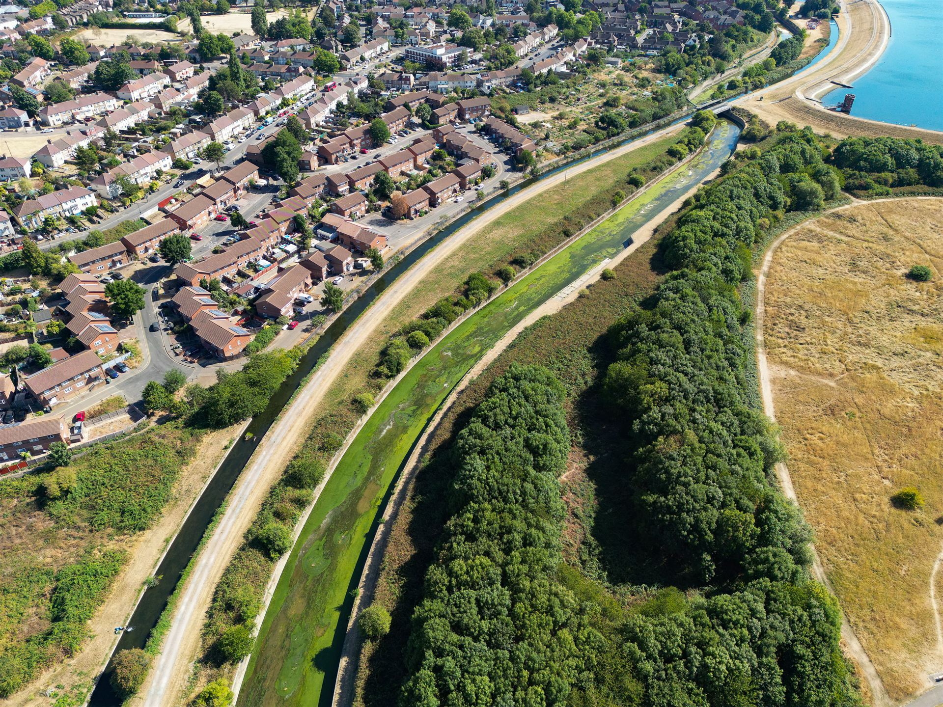
2D hydraulic models (HEC-RAS 2D, LISFLOOD-FP) are accurate but slow — a single storm simulation may take hours, making real-time flood mapping computationally impractical for operational early warning. Surrogate models — simplified AI representations that mimic the input-output behaviour of a full hydraulic model at a fraction of the computational cost — are an emerging solution. Trained on ensembles of pre-computed hydraulic simulations covering a range of flow conditions, these surrogate models can predict flood extent and depth in seconds, enabling probabilistic, near-real-time inundation mapping for civil protection.
| AI Application | Technique | Maturity | African Relevance |
|---|---|---|---|
| Rainfall-runoff modelling | LSTM, GRU, Transformer | High — operational in several national services | High — addresses gauge data scarcity |
| Flood early warning | Ensemble ML + NWP coupling | High — GloFAS uses ML components | High — critical for Nigeria's flood risk |
| Ungauged basin estimation | Transfer learning, PUB | Medium — active research | Very high — most basins ungauged |
| Hydraulic surrogate models | Neural net emulators | Medium — research to operational | Medium — needs local hydraulic data |
| Drought forecasting | Random Forest, XGBoost, LSTM | Medium — regional implementations | High — agricultural water security |
| Water quality prediction | ANN, gradient boosting | Medium — site-specific | Medium — urban water supply |
4. Water Supply and Sanitation: Smart Networks and Leakage Detection
Urban water distribution network management is a domain where AI is delivering measurable operational improvements in cities where digital infrastructure exists. Smart meters generating continuous flow and pressure data, combined with machine learning anomaly detection algorithms, can identify pipe bursts, leaks, and illegal connections in near-real-time — before the fault escalates into a major service disruption or infrastructure failure.
Leakage in Nigeria's urban water distribution systems is estimated at between 40% and 60% of distributed volume — a staggering economic and resource loss. AI-based non-revenue water reduction programmes, combining acoustic pipe monitoring data, hydraulic model calibration, and machine learning-based leak localisation, have demonstrated 15–30% reductions in leakage in comparable utility contexts in Ghana, South Africa, and Kenya. The limiting factor in Nigerian cities is not the AI technology but the underlying digital infrastructure: functioning meters, connected supervisory control systems, and reliable data pipelines.
At the wastewater treatment end, AI-driven process control systems optimise aeration energy consumption, chemical dosing, and sludge management in real time — reducing operational costs by 10–25% in utilities where they have been deployed. Effluent quality prediction models using sensor data enable predictive compliance monitoring without the cost of continuous laboratory analysis.
5. Transportation and Highway Engineering
Pavement condition monitoring
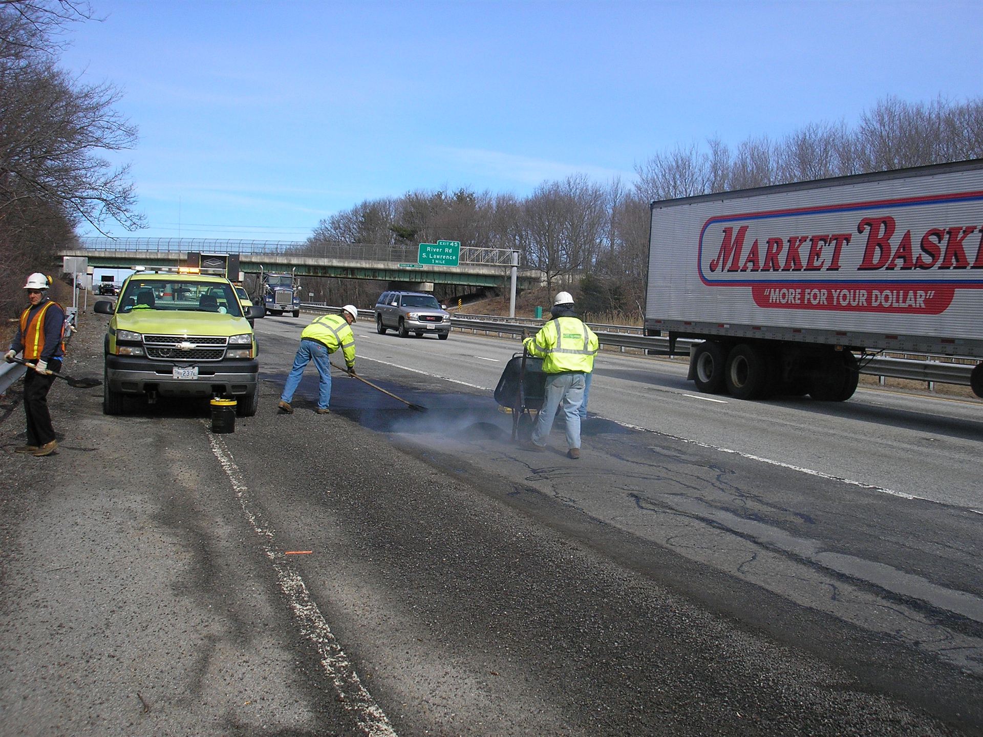
Road network management is data-intensive and historically labour-intensive. Visual pavement condition surveys — teams of technicians walking or driving road sections, manually recording distress type, extent, and severity — are slow, expensive, inconsistent, and hazardous. AI-powered pavement condition monitoring using vehicle-mounted cameras and LiDAR sensors, combined with deep learning classification models, can survey thousands of kilometres of road per day with consistent, objective, quantified distress data.
For highway agencies managing large networks — including the Federal Roads Maintenance Agency (FERMA) and state roads ministries in Nigeria — AI-based pavement condition monitoring could transform the quality and cost-effectiveness of their condition data, which currently underpins maintenance budget allocation decisions. The technology is already deployed commercially by companies including Fugro, Pavemetrics, and RoadBotics, and is being adopted by several African highway agencies.
Traffic forecasting and demand modelling
Graph Neural Networks (GNNs) trained on historical traffic count data and network topology can predict travel demand, congestion patterns, and the traffic impact of infrastructure interventions with greater accuracy than traditional four-step transport models. These models are computationally efficient enough to support real-time adaptive signal control and dynamic route guidance systems — though the infrastructure investment required to deploy such systems at scale in Nigerian cities remains substantial.
Highway alignment and earthworks optimisation
AI-assisted highway design tools can optimise road alignments simultaneously for multiple competing objectives — earthworks balance, gradient constraints, construction cost, environmental impact, and accident risk — across a terrain model, producing candidate alignments that a human designer would not identify through manual iteration. Platforms embedding this capability — including InfraWorks and OpenRoads Designer — are being adopted in transport infrastructure planning in Africa.
6. Construction Management: From the Drawing Board to the Site
Building Information Modelling and generative AI
Building Information Modelling (BIM) has transformed design coordination, clash detection, and quantity extraction — but it remains largely a tool for representing human design intent rather than generating it. Generative AI is beginning to change this. Large language models integrated with BIM authoring tools can interpret design briefs in natural language, query and modify model parameters, and generate compliant structural and MEP arrangements from high-level specifications. Autodesk's AI features in Revit and Civil 3D, and similar integrations in Bentley OpenBuildings, represent the commercial frontier of this development.
For quantity surveyors and cost engineers, AI systems trained on historical project cost databases can produce order-of-magnitude and budget estimates from model geometry or scope descriptions with a fraction of the effort of traditional bill-of-quantities preparation — though the reliability of these estimates depends heavily on the quality and representativeness of the training data relative to the project context.
Progress monitoring with computer vision
Regular photographic or video documentation of construction sites, combined with deep learning object detection and semantic segmentation, enables automated progress monitoring against the project schedule. AI systems can identify installed structural elements, classify construction activities, measure earthworks progress from drone imagery, and flag deviations from the planned sequence — providing project managers with objective, frequent progress data without the cost of dedicated monitoring personnel. On large infrastructure projects — dams, road contracts, urban drainage schemes — this capability can substantially reduce the cost of contract supervision.
On the Dangote Refinery project, drone-based site monitoring supported project management of one of the world's largest single-site construction programmes. Similar approaches are now being adopted on major federal road projects in Nigeria, where contract supervision capacity has historically been a significant governance challenge.
Safety monitoring
AI-powered video analytics applied to site CCTV feeds can detect personal protective equipment (PPE) compliance violations — workers without helmets or harnesses — in real time, alerting site safety officers to unsafe conditions before incidents occur. These systems are commercially available and cost-effective even on medium-scale construction contracts.
7. Environmental and Climate Engineering
Environmental impact assessment screening
Environmental Impact Assessment (EIA) processes are documentation-intensive. AI document analysis tools — using Natural Language Processing (NLP) and large language models — can screen project descriptions against environmental sensitivity databases, identify relevant regulatory requirements, extract key technical parameters from baseline reports, and draft standard sections of environmental documents. These tools do not eliminate the need for expert environmental judgement, but they substantially reduce the clerical burden of EIA production, enabling consultants to focus professional time on genuinely substantive analysis.
Erosion modelling and sediment management
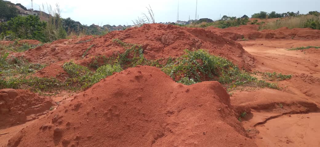
Gully erosion is one of the most severe land degradation processes in south-eastern Nigeria. AI models combining topographic data, satellite-derived land use and rainfall, and field erosion inventory datasets can predict gully initiation, growth, and sediment yield at catchment scale — providing the spatial prioritisation needed for effective erosion control investment under programmes like NEWMAP. Machine learning models (Random Forest, XGBoost) have consistently outperformed the Revised Universal Soil Loss Equation (RUSLE) in gully erosion susceptibility mapping when trained on local field data.
Climate change impact modelling
Regional climate models produce output at resolutions (25–50 km) that are too coarse for infrastructure design, which typically operates at the scale of individual catchments or project sites. Statistical and machine learning-based downscaling methods — including Quantile Delta Mapping (QDM), BCSD, and deep learning-based super-resolution approaches applied to climate model output — are being used to translate GCM projections into the localised, high-resolution rainfall and temperature scenarios needed for climate-resilient design. These methods are more computationally efficient and in some validations more accurate than dynamical downscaling using nested regional climate models.
8. AI in the Nigerian and African Engineering Context
Any honest discussion of AI in civil engineering must address the gap between the conditions assumed by most published research and those that actually prevail in Nigeria and Sub-Saharan Africa. Most AI tools for engineering have been developed and validated in data-rich, high-infrastructure environments — North America, Europe, East Asia — where digital records, sensor networks, and computation are taken for granted. The African context differs in ways that matter.
Data scarcity remains the binding constraint
Machine learning models are as good as the data they are trained on. Nigeria has extensive engineering infrastructure — thousands of kilometres of roads, hundreds of dams, urban water networks serving tens of millions — but the digital records documenting this infrastructure are fragmented, inconsistently maintained, and often inaccessible. Historical streamflow records from NIHSA are incomplete. Pavement condition data for federal roads is not systematically digitised. Geotechnical investigation records from past projects are rarely archived in searchable databases.
This means that the most powerful AI applications — those requiring large, well-labelled training datasets specific to local conditions — cannot be directly imported from Western research. They require local data collection, local model training, and local validation. This is a challenge, but also an opportunity: the organisations and firms that invest in systematic data collection and curation now will have a decisive advantage as AI tools mature.
Opportunities that are specifically relevant to Nigeria
- Satellite-based flood early warning: AI-driven early warning using satellite rainfall (IMERG, ERA5) and global streamflow models (GloFAS) can provide flood alerts for ungauged basins — directly addressing Nigeria's urgent need for improved flood risk management in the Niger Delta and Middle Belt.
- Road condition monitoring from mobile imagery: Low-cost smartphone-based road condition surveys using deep learning models are being developed for low-resource environments, avoiding the need for expensive dedicated survey vehicles.
- AI-assisted design checking: LLM-based tools that can check structural or hydraulic calculations against Nigerian design codes (COREN standards, FMWH hydraulic design manuals) could significantly reduce errors in design submissions — particularly for smaller firms without dedicated checking staff.
- Erosion and gully susceptibility mapping: Machine learning susceptibility models calibrated on NEWMAP and ACReSAL project data could support systematic national-scale erosion risk prioritisation.
- Construction supervision support: Drone-based progress monitoring and AI-assisted contract administration tools could improve the quality and consistency of supervision on federally funded infrastructure projects.
9. The Limits of AI in Engineering: What It Cannot Do
A sober assessment of AI in engineering requires equal attention to its limitations. The enthusiasm of technology vendors and the pace of research publication can create a distorted impression of current capability.
AI cannot exercise engineering judgement
Engineering judgement — the ability to make sound decisions under uncertainty, with incomplete information, in novel situations, integrating technical knowledge with contextual understanding and professional accountability — is not something current AI systems possess. An AI model can identify that a slope has characteristics similar to slopes that have failed in its training dataset. It cannot tell you whether the specific combination of site conditions, construction sequence, seasonal groundwater variation, and political pressure to open a road ahead of schedule makes this particular slope accept-able risk in this particular context. That requires a registered professional engineer making a judgement call and accepting legal and ethical responsibility for it.
AI models fail outside their training distribution
Machine learning models perform well within the range of conditions represented in their training data, and can fail dramatically — and silently — when applied outside that range. A flood forecasting model trained on historical rainfall-flow relationships may produce confident but entirely wrong predictions for a 1-in-200-year event that lies well outside the historical record. An AI-generated structural design optimisation may propose a configuration that performs well under the load cases explicitly included in training but has unforeseen vulnerability under an unanticipated load combination. Engineers using AI tools must understand this fundamental limitation.
AI requires good data to produce good results
The well-known phrase "garbage in, garbage out" has never been more relevant. An AI model trained on incorrect, unrepresentative, or biased data will produce incorrect, unrepresentative, or biased outputs — often with apparent confidence. In engineering contexts, where the consequences of error include structural failure, flooding, or contamination, the quality assurance of AI training data is a professional responsibility that cannot be delegated to the algorithm.
Explainability and regulatory acceptance
Many high-performing AI models — deep neural networks in particular — are effectively black boxes: they produce outputs from inputs through a process that cannot be straightforwardly interpreted or explained. Regulatory frameworks for engineering design typically require that design choices be justified and documented in terms that a competent reviewer can evaluate. Black-box AI design tools present a challenge to this framework that the profession has not yet fully resolved. Physics-informed neural networks (PINNs) and explainable AI (XAI) techniques are active research areas addressing this limitation, but are not yet mainstream in engineering practice.
The most dangerous failure mode in AI-assisted engineering is not the AI making a spectacular, obvious error — it is the AI making a plausible-sounding error that a technically credible engineer, under time pressure, fails to detect. Professional competence remains the last line of defence.
10. The Tools Shaping Practice Today
Structural Design
Autodesk Structural Bridge Design, ETABS AI features, Rhino-Grasshopper generative design, and Speckle for model-based collaboration.
Hydrology & Flooding
Google Flood Hub, GloFAS AI components, LSTM models via TensorFlow/PyTorch, Neuralhydrology Python library for rapid basin modelling.
Roads & Transport
RoadBotics AI pavement assessment, Bentley OpenRoads AI alignment, drone-based earthworks monitoring via Skycatch and DroneDeploy.
Environmental
Google Earth Engine ML classifiers, Random Forest erosion susceptibility, NLP-based EIA screening, CORDEX downscaling tools.
Construction
Doxel and Reconstruct AI progress monitoring, Procore AI-assisted scheduling, Smartvid safety analytics, drone photogrammetry platforms.
Geotechnical
Datamine and Leapfrog for subsurface ML modelling, Geo-AI slope stability tools, SHM platforms using LSTM anomaly detection.
11. Can AI Take Civil Engineering Jobs? An Honest Discussion
This is the question that runs beneath every conference presentation and LinkedIn post about AI in engineering. Colleagues ask it quietly. Students ask it openly. It deserves a direct, evidence-based answer rather than reassuring platitudes or alarmist headlines.
The honest answer is: yes, for some tasks and roles; no, for the core of professional engineering practice. The nuance matters enormously.
What AI will displace — and already is
AI will — and in some cases already does — displace the routine, repetitive, rule-following components of engineering work. Consider the following tasks that junior and mid-level engineers currently spend significant professional time on:
- Manually sizing and checking standard structural members against design codes
- Preparing standard sections of EIA reports and feasibility studies from templates
- Digitising topographic survey data and preparing base maps
- Extracting quantities from drawings and preparing bills of quantities
- Running sensitivity analyses by repeatedly executing the same hydrological model with varied parameters
- Reviewing project documents for regulatory compliance against checklists
- Drafting standard contract correspondence and variation order documentation
- Pavement condition surveys along road sections
- Basic flood frequency analysis by fitting distributions to gauge records
These tasks will not disappear entirely, but the labour required to perform them will shrink substantially as AI tools improve. The engineer who today spends three days preparing a flood frequency analysis will, within five years, spend three hours reviewing and validating an AI-generated analysis. This compression has implications for the staffing levels required to deliver engineering services and — critically — for the career pathways available to early-career engineers.
The experience pipeline problem
There is a serious concern that is not discussed enough in optimistic accounts of AI in engineering. Junior engineers currently develop professional competence by doing — by working through the detailed calculations, grappling with the data, making mistakes on low-stakes tasks, and building the intuition that enables sound senior engineering judgement. If AI tools eliminate the routine tasks through which junior engineers acquire this intuition, where do the competent senior engineers of the next generation come from?
This is not a hypothetical concern. It is already evident in sectors where automation has eliminated entry-level roles. The profession needs to think carefully about how technical competence is developed, transmitted, and assessed in an environment where AI handles more and more of the mechanical work. Mentorship, deliberate competence development, and revised professional development frameworks will become more important, not less, as AI capability expands.
What AI cannot displace
The core of professional engineering practice — the activities for which engineers are registered, licenced, and held legally and ethically accountable — is much more resistant to AI displacement than the routine tasks described above. These include:
- Client engagement and problem definition: Understanding what a client actually needs, translating ambiguous briefs into engineering requirements, managing expectations, and building the trust necessary for complex project delivery requires human relationship skills that AI cannot replicate.
- Multi-criteria decision making under uncertainty: Choosing between dam sites, selecting structural systems, recommending alignments — decisions that balance technical, economic, environmental, social, and political considerations — require the kind of integrative judgement that is the defining contribution of a senior engineer.
- Site investigation and contextual assessment: Reading a site — assessing soil conditions, drainage patterns, flood history, community context, construction access, and local material availability — requires physical presence, sensory observation, and contextual knowledge that remote AI systems do not possess.
- Novel problem solving: Engineering projects routinely present conditions that fall outside the parameters of standard practice. The engineer who can recognise when standard tools do not apply and devise an appropriate alternative approach is exercising a creative and critical capability that AI does not possess.
- Professional accountability: Stamping a drawing. Signing an EIA. Certifying a dam safety report. These acts carry legal, professional, and ethical weight. They require a registered professional who has exercised personal judgement and accepts personal responsibility. AI cannot be registered. AI cannot be sued. AI cannot be deregistered. The human engineer who uses AI tools remains fully accountable for the outputs.
- Stakeholder and community engagement: Public consultations, community liaison, negotiation with government agencies, presentation to boards of inquiry — these are fundamentally human activities requiring communication, empathy, cultural sensitivity, and persuasion.
Professional Exposure Assessment
Higher Automation Exposure
- Routine structural checking & sizing
- Standard quantity surveying
- Document drafting from templates
- Pavement & site condition surveys
- Flood frequency statistical analysis
- Bill of quantities preparation
- Basic hydrological model execution
- EIA template sections
Lower Automation Exposure
- Registered design sign-off
- Client engagement & problem definition
- Site investigation & judgement
- Novel or non-standard problem solving
- Multi-stakeholder decision facilitation
- Community & regulatory liaison
- Dam safety & risk assessment
- Expert witness & dispute resolution
The Africa dimension: a different displacement timeline
In Nigeria and much of sub-Saharan Africa, the AI displacement timeline is likely to be longer than in high-income countries, for a combination of structural and institutional reasons. The digital infrastructure required to deploy AI tools at scale — reliable connectivity, cloud computing access, digitalised project records, smart sensors — is still being built. Regulatory frameworks for AI-assisted engineering design do not yet exist. Professional acceptance of AI-generated outputs is nascent. And the supply of engineers relative to the enormous infrastructure deficit means that demand for engineering services substantially exceeds current supply — a labour market condition that buffers against displacement even as productivity tools improve.
This does not mean African engineers should be complacent. The engineers who develop genuine AI literacy now — who understand what these tools do, how to use them critically, and where their limitations lie — will be positioned to deliver engineering services at a quality and speed that competitors without these skills cannot match. The competitive advantage is not in resisting AI but in deploying it more effectively and more responsibly than anyone else.
The profession's response
Professional engineering bodies — NSE, COREN, ICE, ASCE, and their counterparts globally — are beginning to grapple with the implications of AI for professional practice. The emerging consensus points in several directions: AI tools must be used under the supervision and accountability of registered engineers; AI-generated outputs must be subject to independent professional review before being used as the basis for design decisions; competence in AI tool use should be incorporated into CPD frameworks; and the profession should engage proactively with AI developers to ensure that tools are designed in ways that support rather than undermine engineering accountability.
There is also a strong case for engineering education reform. Universities producing civil engineers in 2026 and beyond need to ensure graduates are AI-literate — not just familiar with specific tools, but equipped with the underlying understanding of machine learning concepts, data quality, model validation, and algorithmic limitations that allows them to use AI tools critically rather than credulously.
Conclusion: Augmentation, Not Replacement
The trajectory of AI in civil and water resources engineering is not a story of replacement — it is a story of augmentation, and of redefinition. The engineer of 2035 will spend less time on routine calculation and more time on problem definition, stakeholder engagement, design governance, and the validation of AI-generated analysis. The parts of engineering that are most distinctly human — judgement, accountability, creativity, and contextual wisdom — will become more central to professional identity, not less.
This is not cause for complacency. Engineers who do not develop AI literacy will find themselves at a competitive disadvantage relative to those who do. Firms that do not invest in AI-capable workflows will lose efficiency relative to those that do. But the qualified, experienced, accountable registered engineer — the professional who can take a complex problem, integrate technical analysis with contextual judgement, make a defensible decision, and accept responsibility for the outcome — is not a job description that an algorithm can fill.
The most important skill for engineers navigating this transition is not prompt engineering or Python scripting — though both are useful. It is critical thinking: the ability to evaluate AI outputs with the same rigour applied to any other engineering input, to recognise when a model is operating outside its validated range, to ask the right questions, and to know when professional judgement must override algorithmic confidence. That capacity is, and will remain, the foundation of sound engineering practice.
The engineer who fears AI is like the cartographer who feared satellite imagery — right to recognise the disruption, but wrong about the outcome. The map-makers who embraced remote sensing produced better maps, faster, and found entirely new applications for their expertise. The engineers who engage seriously with AI will do the same.